BY: PHILIPPE DE JOCAS
Volcanic eruptions are more common that you might think. Every few decades, land-based volcanoes blow their stacks and send fiery ash, ejecta, and debris skyrocketing into the air. Pompeii, Krakatoa, and Mount St. Helens are all good examples of what happens when tectonic plates get too hot to handle. But land-based volcanoes, destructive and dramatic as they are, constitute a small fraction of the real volcano business.
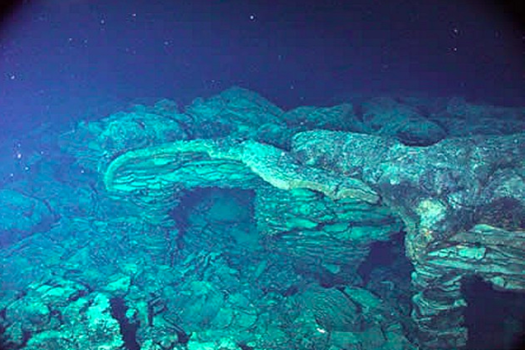
Deep underwater, thousands of feet beneath the surface, tectonic plates rub up and jostle against one another. Great ragged fault lines stretch for miles, releasing a fragment of the Earth’s innermost tectonic energy and forming long, volcanically active ridges and rifts. At the depth and pressure where these volcanoes form, evaporation is impossible, and so these volcanoes produce no smoke or steam. Deep-sea creatures cluster around these oases of warmth and energy, creating fantastic reefs of giant worms, crabs, and snaky fish that exist independently from the sun’s light. It’s thanks to volcanoes that these little communities can cling to life, but can these distant mountain ranges do more than that?
It’s often hard to see what’s going on at the seabed. For one thing, it’s pitch-black, meaning that scientists have to rely on alternative tools such as sonar or thermal imaging to get a clear picture. Only specialized submarines and ROVs are capable of making the trip. So while researchers can’t exactly pop on down to the bottom of the sea whenever a volcano erupts, recent advances have allowed them to do the next best thing.
In April of 2014, Axial Seamount – a young, mid-sized volcano located off the coast of Oregon – threatened to erupt after its caldera spent several months expanding and contracting, a surefire way of signaling that it was about to blow. Unlike any other volcanic event in history, however, this time researchers from the American Geophysical Union were prepared. By running a billion-dollar network of fiber-optic cables and seismometers along the ocean floor, they were able to map the size and spread of the volcano’s magma chamber as the volcano loaded its metaphorical barrel and to watch the eruption in real-time.

The eruption, when it came, was certainly dramatic. The seafloor around Axial Seamount slowly rose as the magma chamber refilled; as the seafloor rose, violent quakes rocked the landscape. Based on the speed of the magma chamber’s refilling, scientists predicted that Axial would blow its stack sometime in 2015. They were right. On the morning of April 24, the volcano erupted after a large crack caused by the rising seafloor allowed the pressurized magma to roar out of the breach. In less than an hour, more than 600 earthquakes demolished the seafloor, and researchers estimated that more than 79 billion gallons of superheated magma had hit the icy water, exploded, and instantly solidified into new rock. It was, overall, a triumph for scientists and pyrotechnics enthusiasts alike.

Scientists around the world hope to take what we learned during Axial Seamount’s eruption and apply it to other “hot spots” around the world to track the seismic activities of other volcanoes. At present, the applications for this technology are somewhat limited. While useful for predicting patterns in stable, well-behaved volcanoes like Axial Seamount, the technology struggles when trying to chart bigger and rowdier volcanoes deep underwater. In the future, scientists and geologists alike may be able to chart the behaviour of these volcanoes, and more accurately predict earthquakes and tsunamis as a byproduct of volcanism, in the same way that meteorologists can chart the weather. Firebrands like these geologists might just change the face of seismography and volcanology.